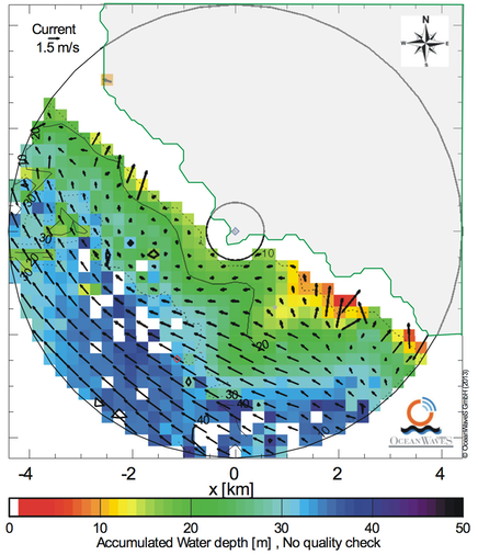
Bathymetry and current field as obtained by a X-band radar with a WaMoS II at Tongue Point, Cape Terawhiti (New Zealand) during high tide, Aug. 15th, 2011, 7:01. The colour represents the water depth, the arrows the current vectors (from: Hessner, K., Reichert, K., Nieto Borge, J.C., Stevens, C.L., Smith, M.J., 2014, “High-resolution X-Band radar measurements of currents, bathymetry and sea state in highly inhomogeneous coastal areas”. Ocean Dynamics. June 2014).